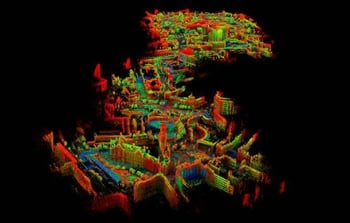
Work is underway to virtually recreate Bradford's city centre.
‘Virtual Bradford’ will create a brick-for-brick high-resolution digital copy of the city centre, and is expected to revolutionise how the council deals with planning, air pollution and traffic management but will also enable a myriad of other potential uses, such as creation of heritage trails and mapping cultural assets in 3D.
 The project is a collaboration between the University of Bradford and Bradford Council to improve public service through smart open-data solutions.
This digital twin will provide accurate levels of detail of the built environment for a number of Bradford Council use cases, including urban/civic planning; improved traffic management; modelling air quality, flood risk and noise pollution; disaster management planning; and to highlight the heritage of the City to enhance education, tourism and civic pride.
The online clone will include most of the city centre but the virtual landscape will be expanded in future. It is anticipated that data from 60 miles of streets will be captured to make the first model.
"This concept of a virtual digital twin of a city goes back quite a few years but the ability to create one has been limited by the expense of the technology. For a long time, it was too expensive for a local authority to build something like this. As the years have gone by, it has become cheaper and easier to do these things," said Syd Simpson, Flood Risk and Mapping Officer at Bradford Council.